


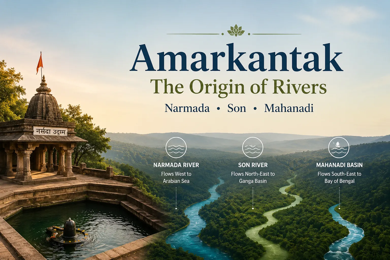
Amarkantak, located where the Vindhya and Satpura range of mountains converge, is one of the most significant geographical and spiritual terrains of the Indian subcontinent. A favorite pilgrimage destination and hotspot of geographical research, this tiny hill town in Madhya Pradesh is supposedly the origin of some of central India’s greatest river systems.
The most known fact for most tourists about Amarkantak is the originating of the holy Narmada River, where in the year, numerous people visit Narmada Udgam Kund. But the low as well as high land of this place has been also the source of many streams originating from Son River and Mahanadi River basin.
The whole of this extraordinary hydrological situation is responsible for making Amarkantak as “The Birth Place of Rivers”. Apart from the religious aspect, it is one of the best natural watersheds in the country, where rivers move in different directions to reach different seas.
If you’re a traveler, lover of geography, student or pilgrim, by the end of your learning of Amarkantak’s rivers you will know why this plateau has been so revered by people all over the world for thousands of years.
Why Amarkantak is Called the “Origin of Rivers”
Amarkantak is about 1,000-1,100 metres (3,300-3,600feet) above sea level on the Maikal Range, a mountain range that is an extension of the Vindhya and Satpura ranges.
Its elevated plateau functions as a major watershed, meaning rainfall falling on different sides of the hills drains into completely different river systems.
From this compact region:
- The Narmada River flows westward toward the Arabian Sea.
- The Son River flows northeast before joining the Ganga basin.
- Numerous seasonal streams flow southeast into tributaries that contribute to the Mahanadi basin.
Very few places in India show this high an amount of drainage division within such a small area.
This watershed has influenced not only the country’s geography but also its culture. Ancient sages regarded Amarkantak as a divine meeting place between mountains, forests, and sacred waters. As a result, the region became an important pilgrimage destination long before modern geography explained its hydrological significance.
Amarkantak today is protected for both its religious as well as ecological significance with thick forests supporting the springs which feed the river systems.
Narmada River — Source & Journey
The Sacred Origin: Narmada Udgam Kund
The Narmada River origin is located at Narmada Udgam Kund, one of the holiest sites in central India.
Rather than emerging as a dramatic mountain stream, the river begins from a sacred spring enclosed within a beautifully maintained temple complex. Pilgrims offer prayers before the water begins its long westward journey across central India.
According to Hindu tradition, the Narmada was born from Lord Shiva’s meditation and is considered one of the seven sacred rivers of India. Many devotees believe that merely seeing the Narmada is spiritually purifying.
The Narmada Udgam Temple Complex includes:
- Sacred kund (spring)
- Ancient shrines
- Meditation areas
- Pilgrim pathways
- Daily aarti ceremonies
For visitors exploring Amarkantak, this is usually the first and most important stop.
Planning a trip to Amarkantak? Read our complete Amarkantak Travel Guide to explore attractions, travel tips, accommodation, and everything you need to know.
Journey of the Narmada River
The Narmada travels approximately 1,312 kilometres, making it one of India’s longest west-flowing rivers.
Unlike most major Indian rivers that flow east into the Bay of Bengal, the Narmada travels through a rift valley between the Vindhya and Satpura ranges before emptying into the Arabian Sea near Bharuch in Gujarat.
Along its journey, the river passes through:
- Amarkantak
- Dindori
- Jabalpur
- Marble Rocks at Bhedaghat
- Omkareshwar
- Maheshwar
- Bharuch
The river supports millions of people through irrigation, drinking water, hydroelectric projects, and agriculture.
Geological Importance
The Narmada follows one of India’s oldest geological fault lines known as the Narmada Rift Valley.
This tectonic depression largely explains why the river flows west while many neighboring rivers flow east.
The valley has also yielded important fossil discoveries, making it one of India’s most significant geological regions.
Religious Significance
Unlike many rivers that are worshipped primarily at their confluence or delta, the Narmada is revered along its entire course.
One of India’s most remarkable pilgrimages is the Narmada Parikrama, a circumambulation of the river stretching over 3,000 kilometres. Pilgrims traditionally walk both banks without crossing the river until completing the circuit, a journey that can take many months.
Son River — Source & Journey
Where Does the Son River Begin?
The Son River origin lies near Amarkantak on the eastern side of the plateau.
Its source is marked by Sonmuda, a scenic viewpoint where water emerges from the hills before descending dramatically into forested valleys.
Unlike the temple-centered origin of the Narmada, Sonmuda offers a more natural landscape with cliffs, forests, and panoramic views.
Visitors often combine Sonmuda with sunrise or sunset sightseeing because of its spectacular scenery.
Course of the Son River
From Amarkantak, the Son River flows northeast through:
- Madhya Pradesh
- Chhattisgarh (briefly)
- Uttar Pradesh
- Bihar
Eventually, it joins the Ganga River near Patna.
With a length of approximately 784 kilometres, the Son is among the largest southern tributaries of the Ganga.
Characteristics of the Son River
The Son River differs significantly from the Narmada:
| Feature | Narmada River | Son River |
| Direction | West | Northeast |
| Destination | Arabian Sea | Ganga Basin |
| Length | ~1,312 km | ~784 km |
| Source Area | Narmada Udgam | Sonmuda, Amarkantak Plateau |
The Son has a wide sandy riverbed and experiences substantial seasonal variation in water flow due to the southwest monsoon.
Historical Importance
Historically, the Son River served as an important transport and trade corridor in central India.
Today, it supports irrigation, agriculture, and several large infrastructure projects across northern India.
Mahanadi River — Does it Really Originate Here?
One of the most frequently searched questions online is:
“Does the Mahanadi originate from Amarkantak?”
The answer requires some clarification.
The Short Answer
No, the main Mahanadi River does not originate directly at Amarkantak.
The officially recognized source of the Mahanadi River is generally identified near Sihawa Hills in present-day Chhattisgarh, several hundred kilometres southeast of Amarkantak.
Why the Confusion?
The confusion arises because the Amarkantak Plateau forms an important watershed, and several small streams flowing from the region eventually become part of the broader Mahanadi drainage basin.
Some older publications and local traditions loosely associate Amarkantak with the beginnings of the Mahanadi system because water originating in the Maikal hills contributes to tributaries that ultimately feed the Mahanadi.
However, in modern geographical classification:
- Narmada originates from Amarkantak.
- Son originates from Amarkantak.
- The main Mahanadi does not originate at Amarkantak.
Why This Matters
Providing this clarification helps travelers, students, and researchers avoid a common misconception found across the internet.
While Amarkantak undeniably influences multiple river systems, distinguishing between a river’s official source and its wider watershed contribution is essential for geographical accuracy.
Geological Reason: The Maikal Range & Drainage Pattern
The remarkable river network around Amarkantak exists because of its unique geological setting.
The Maikal Range
The Maikal Range forms the eastern extension of the Satpura mountains and acts as a natural divide between major drainage systems.
Composed of ancient rocks, forested plateaus, and elevated ridges, the range captures monsoon rainfall before distributing water in multiple directions.
India’s Watershed Divide
Imagine standing on the Amarkantak Plateau during the monsoon.
Rain falling only a few hundred metres apart may ultimately reach entirely different destinations:
- Westward toward the Arabian Sea through the Narmada.
- Northeast toward the Ganga via the Son.
- Southeast into the Mahanadi basin through tributary systems.
This phenomenon makes Amarkantak one of India’s most fascinating examples of radial drainage influenced by elevated topography.
Dense Forests Protect the Springs
The forests surrounding Amarkantak play a vital ecological role.
They:
- Recharge groundwater.
- Protect perennial springs.
- Reduce soil erosion.
- Maintain stream flow during dry months.
- Support biodiversity across central India.
Conservation of these forests directly affects the health of rivers originating from the region.
How Many Rivers Originate from Amarkantak?
This is another common question asked by travelers and students.
The most accurate answer is:
Two major rivers officially originate from the Amarkantak Plateau:
- Narmada River
- Son River
In addition, several smaller streams arise in the surrounding Maikal hills and contribute to larger river systems, including tributaries within the Mahanadi basin.
Therefore, while Amarkantak is widely celebrated as the “Origin of Rivers,” geography distinguishes between major river sources and watershed-fed tributaries.
Best Places to Experience the River Origins
Visitors interested in Amarkantak’s hydrology should explore these key locations:
- Narmada Udgam Kund — Sacred origin of the Narmada River.
- Sonmuda Viewpoint — Source area of the Son River with breathtaking valley views.
- Kapildhara Falls — One of the first waterfalls formed by the young Narmada.
- Dudh Dhara Falls — A scenic downstream cascade surrounded by forests.
- Mai Ki Bagiya — A serene grove associated with the early flow of the Narmada.
Together, these sites provide a complete understanding of how water emerges from the plateau and develops into major rivers.
Read our detailed guide to Places to Visit in Amarkantak for timings, rituals, and visitor tips at Narmada Udgam Kund.
Frequently Asked Questions
1. Where is the Narmada River origin?
Flowing from the Narmada Udgam Kund in Amarkantak in Madhya Pradesh, Narmada River is one of the five holy head waterways.
2. Where is the Son River origin?
The Son River begins near Sonmuda, close to Amarkantak, before flowing northeast toward the Ganga.
3. Does the Mahanadi originate from Amarkantak?
No. The source of Mahanadi main is normally taken to be near Sihawa Hills in Chhattisgarh. But since the tributaries coming out of Amarkantak Plateau do contribute to the broad Mahanadi drainage basin, it is sometimes rather confusing.
4. How many rivers originate from Amarkantak?
Two important rivers – the Narmada and the Son-the tap their true source within Amarkantak. Water from this region also flows into tributaries that drain into other river systems such as the Mahanadi basin.
5. Why is Amarkantak famous?
Amarkantak is – Head of the Holy Narmada River, Head of the Son River, Urban temples, dense jungle, Shikhara, Waterfalls and its geographical position – one of the most eastern and south-western watersheds in India.
Final Thoughts
Amarkantak is a lot more than a pilgrimage site. It is a unique confluence of geochemical, ecological and spiritual phenomena. For centuries these 1300 meters high mountains have been nurturing the genesis of rivers that have sculpted lands, cultures and lives of millions of Indians through the ages.
The holy waters of Narmada, the vast extent of the Son, and the plateau that feeds several drainages make this area one of the most unique natural wonders of India. So, if you’re coming to be blessed at Narmada Udgam, be awe-struck by the Himalaya or just to understand India better – Amarkantak will meet your expectations!
One response to “Amarkantak: The Origin of the Narmada, Son & Mahanadi Rivers”
[…] why Amarkantak is famous as the Origin of the Narmada, Son & Mahanadi Rivers in our detailed […]